


Les Gets - Plateau de Loex - Parcours 2 plus long 17km - 600+

HG74250
User
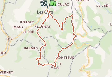

Length
18.4 km

Max alt
1660 m

Uphill gradient
650 m
Km-Effort
27 km

Min alt
1166 m

Downhill gradient
656 m
Boucle
Yes
Creation date :
2020-08-19 07:26:17.191
Updated on :
2020-08-20 18:33:55.5
1h51
Difficulty : Medium

FREE GPS app for hiking
 SityTrail
IGN / Geographical institutes
SityTrail Plus
The world is yours!
About
Trail Mountain bike of 18.4 km to be discovered at Auvergne-Rhône-Alpes, Upper Savoy, Les Gets. This trail is proposed by HG74250.
Description
Variante du Plateau de Loex 17km
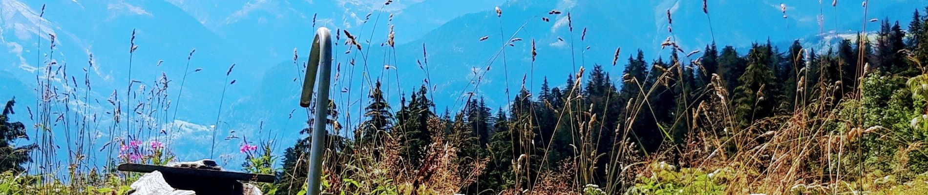
Photos

Positioning
Country:
France
Region :
Auvergne-Rhône-Alpes
Department/Province :
Upper Savoy
Municipality :
Les Gets
Location:
Unknown
Start:(Dec)
Start:(UTM)
319929 ; 5114068 (32T) N.
Comments